The Prototypical Smart City

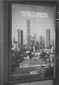
Welcome to Singapore, The Intelligent Island.

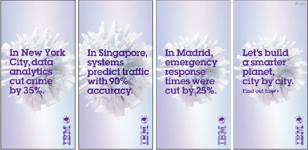
No not the sign greeting you at Changi when you land now but the sign back in 1989 which we show to the left. For the last 25 years, Singapore has been in the vanguard of the information society and this must now be the most automated place on the planet. The panels above which feature as advertisements around the city and are fed to your web pages when you access media such as BBC News from Singapore tell the same story. My attendance at the various cities conferences this past week besides revealing that cities are now really hot topics in terms of their media focus, also suggests that these are now the hot spots where the world’s software companies see their new markets. Main frame went to mini, then mini to desktop and on to handheld while big computing and big data has gone from the scientific lab to the company to the city where all the action now is. With Singapore’s reputation as a no nonsense place to do business and a place where order and organisation are everything, the world’s biggest IT providers – IBM, Cisco, Intel and so on – are poised to introduce all kinds of new systems that provide services and management on a city wide basis.

This is the last day of the World Cities Summit and the Exhibition associated with the conference contains a really wide selection of smart cities solutions from the key software houses and many small start ups as well as public agencies in the region. In fact it is worth looking at MIT Senseable Cities Lab in Singapore where they have several projects such as Live Singapore which are doing the same and more than we are doing in CASA with our online mobility data onLondon’s transport systems. Look at their visualisations to see how the city might someday to be truly online. I say someday but at the current rate of change as this meeting has suggested it may well be tomorrow!

Posted in Big Data, Flows, Networks, Smart Cities | Leave a comment

Early Flow Maps

In researching for my talk at Peter Hall’s 80th Birthday Symposium this coming Monday in UCL’s Darwin Lecture Theatre, I came across Raymond Unwin’s book Town Planning in Practice – An Introduction to the Art of Designing Cities and Suburbs (Fisher-Unwin, London) first published in 1909. In fact, Raymond Unwin might have been the first town planning professor in UCL for he was certainly connected to the College before Stanley Adshead took the first chair in 1914 but this alternative history is buried in the mists of time.

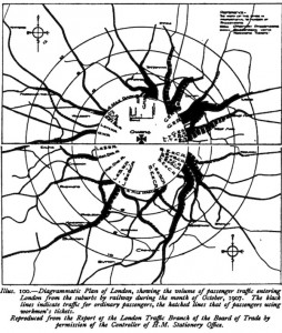
In Unwin’s book which as its name suggests is a work of ‘art’ not ‘science’ in the sense of our meaning of  Science of Cities, there are some forerunners of our science in the map reproduced above from a 1906 Board of Trade Report on London’s Railways, Note the flow diagram, showing a much greater flow from the east and north east than there is today. But not the radial shape so characteristic still of our large cities everywhere. Of course on one of my blogs I traced the first flow map like this to Henry Harness in 1837 and then there was Charles Minard and his famous maps in the middle 19th century but the above is as good as its gets in terms of flows. Unwin’s book has been digitised by Google and you can get it online.

Posted in Flows, Interactions, Networks | Leave a comment

Simulation, Scenario and Visioning …

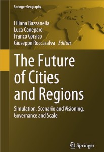
The header of this post is the subtitle of a new book The Future of Cities and Regions edited by Bazzanella, Caneparo, Corsico, and Roccasalva. Computation has finally drawn us to the point where planning support systems informed by simulation and visualization is central to fashioning scenarios about the future. There are a variety of techniques portrayed here at different scales from space syntax-like methods to traditional land use transport interaction (LUTI) models. Some familiar faces write here and I write the last chapter entitled Integrated Tools for Planning Support in an Online World. As one might imagine you don’t need to buy the hard copy but read it online and if you are really persistent you can find in on Google Books. Enjoy.

Posted in Agent-Based Models, LUTI models, Planning Support, Urban Models | Leave a comment