Science and the City

NYC-Brooklyn

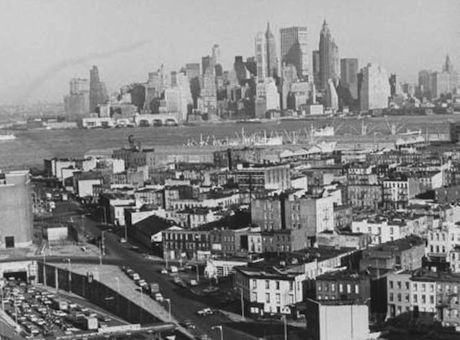
Amazingly as far back as January 1967, we were quite literally talking about ‘a science of cities’, using the cliche. Jennifer Light’s book From Warfare to Welfare published in 2003 recounts the optimism of the 1960s in which many believed that one could import the products of the space program specifically and the military industrial complex more generally into tools that we might used for solving the urban crisis. In America this was the crisis of segregation and poverty in cities as well as traffic congestion, housing conditions and endemic decay. We have just returned from CUSP in NYC where we met with other groups from the US – from Chicago (U Chicago Argonne), Brooklyn (NYU CUSP) and Boston (Harvard) – where we have been discussing the emergence of urban informatics, the role of big data and the new science of cities that weaves itself around such ideas.

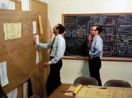
But we tend to forget that we have been here before in the 1960s and it is well worth looking at what was said then. The pamphlet referred to was produced by Volta Torrey for HUD (Housing and Urban Development) and published in January 1967. It was prepared after a major meeting on Science and Urban Development held at Woods Hole in June 1966 which brought together a wide variety of scientists and policy makers as well as planners and engineers. Its contents make fascinating reading, and those of us who are scholars of urban and planning history will be intrigued by its perspective. The world is very different now but the sentiments are much the same. I have scanned the document (no worries about copyright 47 years on from a pamphlet from HUD!) and made it available online if you click here or the picture above. There are so many evocative quotes that I hesitate to pick any out but one depicts the exact same picture that we have today is as follows: “The name of the urban game,” as one of the Woods Hole conferees pointed out, “is information processing”. This is what we were gathered to discuss 47 years later at CUSP in downtown Brooklyn.

Posted in Big Data, Complexity, Information, Planning Support, Smart Cities | Leave a comment

The Beginnings of GIS

carl-picture-2

UCL has many famous sons. Brian Berry graduated here in 1955 before he went Stateside and Roger Tomlinson, the ‘father of GIS’ who coined the very term in the early 1960s, did his PhD here. Carl Steinitz who is a visiting professor now in CASA but who spent his life at the Harvard Graduate School of Design was on the shop floor of the movement from the very beginning training an army of influential people such as Jack Dangermond who founded ESRI. Last year, Carl launched his book A Framework for Geodesign at CASA and Michael Hebbert, the Editor of Planning Perspectives, was present when Carl told us something of the history of GIS. Mike convinced Carl to put all this together from which this excellent paper The beginnings of geographical information systems: a personal historical perspective has now been published in this journal. This is esential reading for all those involved in the movement and especially for thiose who relish the way compouters and graphics have evolved since those early days.The picture above is Peter Rogers and Carl Steinitz exploring paper outputs from their computation in 1967. Note the ties !

Posted in Complexity, Geodesign, Hierarchy, Information, Planning Support | Leave a comment

China Rising: Beijing City Lab

BeijingCL

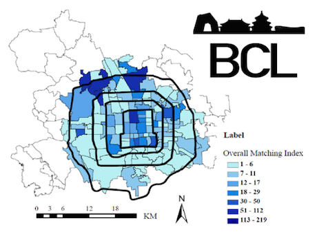
A fascinating virtual lab pulling together research in urban science focussed on researchers from several Chinese universities and agencies in Beijing. From their site, they say “The Beijing City Lab (BCL) is a virtual research community, dedicated to studying, but not limited to, China’s capital Beijing. The Lab focuses on employing interdisciplinary methods to quantify urban dynamics, generating new insights for urban planning and governance, and ultimately producing the science of cities required for sustainable urban development. The lab’s current mix of planners, architects, geographers, economists, and policy analysts lends unique research strength.” Drill down for working papers, reports and new research into the structure and function of Beijing with some interesting research in big data and urban movement. But the site also contains work by Chinese scholars on other applications, for example some in the UK and elsewhere. It was founded by Dr. Ying Long 龙瀛.

The site continues saying “The BCL is … China’s first open urban research network, and contributing to the global intellectual commons. The BCL produces and disseminates knowledge of Beijing in a number of ways: 1. The BCL serves as a networking platform for its research fellows and student members. 2. Urban researchers are invited to use the working paper series to disseminate their findings about Beijing. 3. The BCL’s data-sharing scheme provides open research data about Beijing to the wider scientific community.

Posted in Agent-Based Models, Big Data, Cellular Automata, LUTI models, Networks, Smart Cities | Leave a comment